Contact Us
Services
Services
Tree Services in Sydney
Arborist Reports From Tree Experts
Australian Tree Consultants Pty Ltd provides a wide range of professional arborist services throughout Australia and beyond, working seven days a week for clients.
Whether you need general maintenance services, an arborist report or expert advice on hazardous issues, our expert team can assist with whatever you need using advanced and cutting-edge technology.
We Adhere to All Relevant OH&S requirements from the Amenity Tree Industry
Our Tree Services
Tree Inspections
We can carry out both ground and aerial inspections via a VTA (Visual Tree Assessment). If aerial surveys are required, however, we have the skills and equipment to do this, adhering to all the relevant OH&S requirements from the Amenity Tree Industry.
We also use drones, both fixed-wing and multi-propped helicopter drones, for mapping, aerial imaging, topography for vegetation mapping, infrared and R.B.G surveys and Picus ultrasound technology. We are fully CASA-licensed and our excellent reputation has yielded long-standing relationships with local councils and local, state and federal consent authorities.
Preliminary Tree Assessment Includes:
- Visual inspection from ground-level on the tree, soil, microclimate and surrounding environment (built or fixed structures)
- A tree survey form with tree hazard ratings
- A Resistograph and a Picus Sonic Tomograph
Tree Hazard Assessment Survey Audits
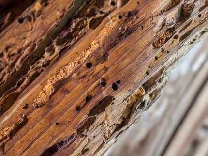
Our team can perform a tree audit to identify any defects (such as termite, borer and fungal attacks) and recommend the best course of action based on the results. Australian Tree Consultants Pty Ltd has developed a tree hazard classification system that provides a simple numerical and colour-coded reference system, allowing us to prioritise any work.
Arborist Reports
We can provide detailed arborist reports detailing the overall health of your trees, including information on the structure, condition and SULE (Safe Useful Life Expectancy and the new system of TreeAZ). If previous tree work has been performed, then an assessment is made in accordance with the Code of Practice for the Amenity Tree Industry 1996.
All assessments, reporting and recommendations, including pruning specifications, are prepared in accordance with Australian Standard 4373.
Tree Maintenance, Cabling and Bracing
We’ll work with you to develop a suitable maintenance programme for your trees, both in the short- and long-term. This may include tree cabling and bracing or branch popping as well as creating tree root barrier systems. Each site will be assessed an treated individually.
Soil Testing
We are equipped to conduct accurate soil pH readings to two decimal points to ensure your soil profile is healthy and suited to the environment. Testing is completed in the field to get an instantaneous soil profile and also to check the soil temperature, which determines the benefit of mulch around trees. During the testing process, we look for elements such as:
- Salt metre
- Sodium ion
- Potassium ion
- Nitrate
- Calcium
- Conductivity metre
Moisture levels (excess moisture from burst water pipes, etc. that can cause trees to decline or die)